Silimna, Tripoli, Arcadia,Peloponnese
Castle in Kokkinies

| Location: |
| On the hill “Kokkinies” 1.2km north of Silimna and 4km west of Tripolis in Arcadia |
| Region > Prefecture: |  |
| Peloponnese Arcadia | |
| Municipality > Town: | |
| City of Tripoli • Silimna | |
| Altitude: | |
|
Elevation ≈ 1055 m (Relative Height≈250 m) |
| Time of Construction | Origin | |
| Mid Byzantine period | BYZANTINE |
|
| Castle Type | Condition | |
| Dry-Stone Fortification |
In Ruins
|
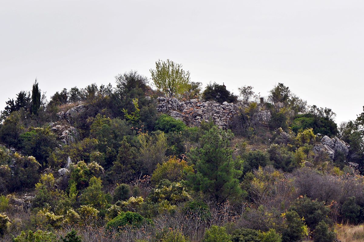
Castle remains on a mountain northeast of the castle of Silimna, in Arcadia.
The mountain peak – together with the surrounding mountainous area – is called “Kokkinies”.
The castle has visual contact with Tripoli and borders the mountainous area of Trikorfa, where several makeshift forts were created during the Greek Revolution.
History
The history of the castle is not known. It is not mentioned in the sources.
This location was identified with the castle of Silimna by the 19th century travelers W.M. Leake and W. Loring, but they were probably wrong, as they apparently had not noticed the medieval ruins on the hill of Agia Triada above the village of Silimna.
The construction style (small, semi-finished stones) indicates that it is a rather a medieval construction. It certainly does not belong to the Frankish period, because: 1) the Franks were not very interested in this particular area (after all, they lost it at the beginning of the 14th century), 2) the mountainous areas with high altitude were not suitable for Frankish fiefdoms, 3) The masonry does not look Frankish at all.
So the castle could be characterized as Byzantine and most likely belongs to the Middle Byzantine Period.
The castle must have been useful during the Greek Revolution, in the siege of Tripolitsa, but we do not know anything more specific about it.
Structure, Fortification & Buildings
The castle is oriented from NW to SE and is 100m long. Its perimeter is over 250m.
It is a rough construction. Its walls are made of semi-finished stones from the same mountain without the use of binding mortar.
No wall was observed on the eastern side, because the rock there is steep, and there is a cliff below. On the other sides, the walls are preserved in fragments, completing the natural fortification of the rock. Its northern end, where the gate was probably located, is surrounded by a dry stone wall.
The largest single section of the wall that survives is on the west side (photo 1), where its thickness is 0.50 m.
The castle is divided into two levels –northern and southern– with the southern one being larger, where there is a small plateau of about 45 sq.m.
On the west side, the remains of a cistern and three towers measuring 3✖3m. and –the smallest– 2✖2m.
The northern level is higher than the southern level, from which it is separated by a 2m high rock.
No buildings can be seen inside the castle except for two undefined piles of stones.
The location at Kokkinies can be reached by a path via the Petrolakkas hill, to its east.
| First entry in Kastrologos: | March 2025 |
Sources
- Α. Ι. Μπάλλας, «Τα μεσαιωνικά κάστρα του Μαινάλου», Πελοποννησιακά ΚΑ΄, 1995, σελ.129-192, 168.
- Καλλιόπη Διαμαντή, «Κάστρο στις Κοκκινιές», Αρχαιολογικόν Δελτίον, τεύχος 52/Β1-1997, σελ.228
|
|
| Access |
|---|
| Entrance: |
| Free access |