Neochori, Tripoli, Arcadia,Peloponnese
Castle of Agia Kyriaki in Mantineia


| Location: |
| East of Neochori of Mantineia, on a hill SE of Varson monastery in Arkadia |
| Region > Prefecture: |  |
| Peloponnese Arcadia | |
| Municipality > Town: | |
| City of Tripoli • Neochori | |
| Altitude: | |
|
Elevation ≈ 1065 m (Relative Height≈50 m) |
| Time of Construction | Origin | |
| perhaps 6th cent. | BYZANTINE |
|
| Castle Type | Condition | |
| Dry-Stone Fortification |
In Ruins
|
Ruins of a small and dilapidated – but visible – dry stone fortification enclosure at the top of the “Agia Kyriaki” hill near the Monastery of Agios Nikolaos Varson, in the mountain Ktenias, northeast of Tripoli.
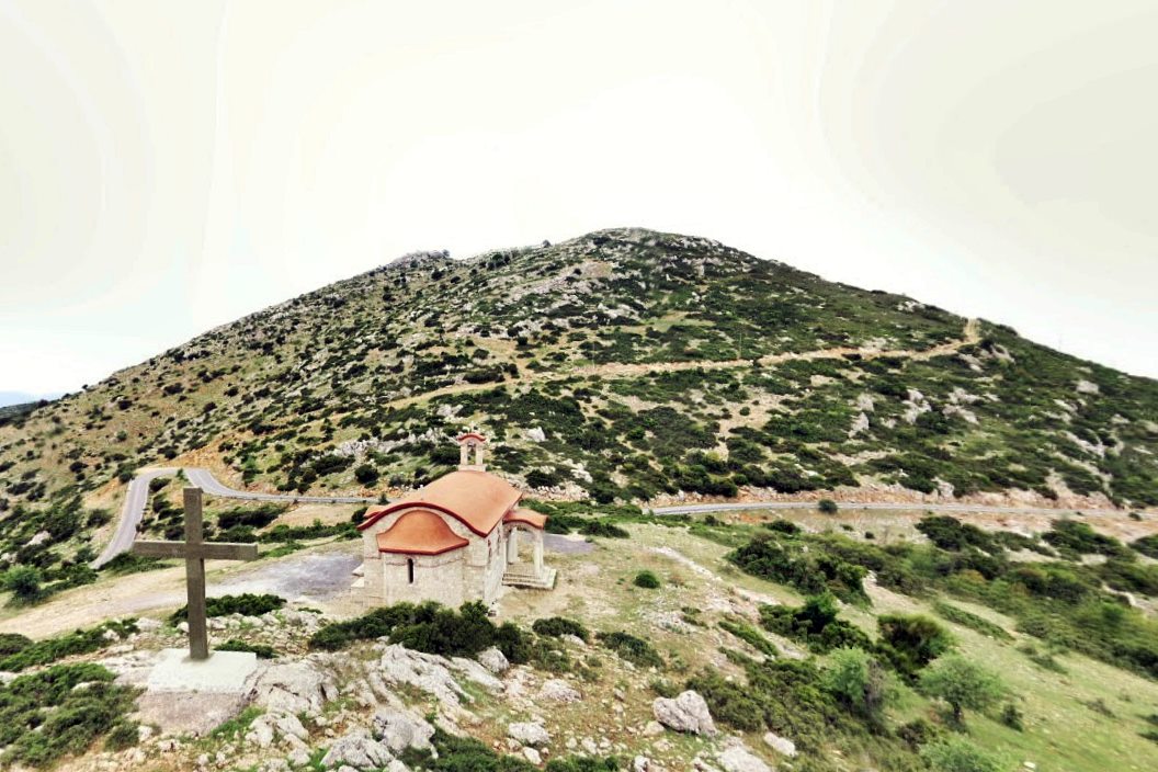
A little lower, 250 meters from the top and from the fort, there is a modern chapel of the Elevation of the Holy Cross, built in 1990-1996 (photo 1).
History
We know nothing from historical sources about the history of this fortification.
From the style, we conclude that it is not an ancient castle. Also, the careless and relatively rough construction method shows that it is not a medieval military fortress. Such structures were used during the Byzantine, and mainly the Early Byzantine Period to protect small settlements.
The surface findings give us some information about the time of habitation. Tiles and a multitude of ceramic fragments, characteristic of the early Byzantine period, were found at the site. Also, a ceramic fragment with a greenish glaze and traces of flaky decoration was found, which can be dated to the 12th-13th century.
A particularly interesting find was a small-sized –28mm– bronze buckle. It has been verified that similar buckles have been manufactured in Corinth and have been dated to the late 6th to early 7th century.
In conclusion, this is a small fortified settlement that was inhabited in the 6th-7th century and probably continued to be inhabited until the beginning of the Frankish rule in the 13th century. A possible time of construction is the end of the 6th century, when the Slavs arrived in the Peloponnese.
Structure, Fortification & Buildings
The hill on its eastern and northern sides has an almost vertical slope. Access to the top is easy from the western side, from where the chapel of the Elevation of the Holy Cross is located.
The fort is at the top of the hill, at an altitude of 1065 m. It covers an area of about 650 sq.m.
The layout of the fortification is not clear, due to the large sections that have collapsed. The shape could be described, as rectangular with the long sides on the N-S axis and with an ellipsoidal shape on the eastern side.
The long western side has a length of 27.50m and a maximum surviving height of 1.70m. Most of it lies on piles of stones. On the southern side, 20m long, was probably the entrance to the fort, as there is an opening 3.20m wide.
Externally, a rectangular building with dimensions of 3.50✖8.0m adjoins the southern side, at a surviving height of 1m.
The eastern elliptical side, extending 25m long, has almost completely fallen into the cliff below. Finally, the northern side is preserved along its entire length of 23m, at a height of 1.50-2.0m.
The thickness of the walls on all sides is around 2.10m.
A short distance from the SW corner of the castle, a circular building with a radius of 1.2m is located, preserved at a height of 0.80m.
In the center, there is a rectangular building in the E-W axis with dimensions 7.80✖7.40m preserved at a height of 1.5m. On its eastern side there is a semicircular formation. It is obvious that these are the ruins of a church, Agia Kyriaki, which, judging from photo 3, operates at least once a year.
Small rough stones without mortar have been used for the construction of the walls and the buildings. The origin of the material is the gray limestone of the hill.
Larger stones have been used in the entrance opening, slightly more processed and in a somewhat more careful arrangement. No use of lime mortar or use of tiles fillings was detected at any point.
Outside the castle, low on the western slope, near the chapel of the Elevation of the Cross, piles of stones were found without any indication of whether they come from a settlement or if they are related to the fort.
| First entry in Kastrologos: | March 2025 |
Sources
- Ε. Ελευθερίου, «Οχυρή Πρωτοβυζαντινή εγκατάσταση στην Αγία Κυριακή Μαντινείας», Ancient Arcadia. Papers from the Norwegian Institute at Athens 8, Αθήνα 2005, 536-46.
- Πhoto 1 from Google Maps, user mvideom drone sky view (2019)
- Photo 3 from Google Maps, user π. Κύριλλος Μαρκαντωνάκης (2025)
|
|
| Access |
|---|
| Entrance: |
| Free access |