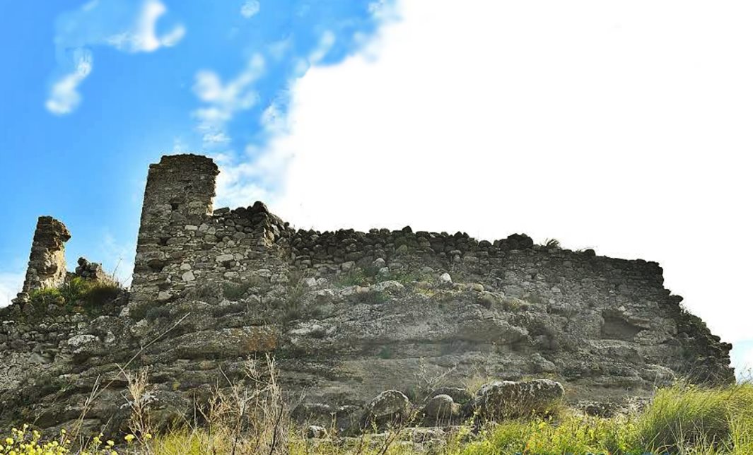
Larani, Gortyna, Herakleion,Crete
Kavalos Tower
| Location: |
| South-west of the village Larani, in the hinterland of Heraclion region, Crete |
| Region > Prefecture: |  |
| Crete Herakleion | |
| Municipality > Town: | |
| City of Gortyna • Larani | |
| Altitude: | |
|
Elevation ≈ 330 m (Relative Height≈80 m) |
| Time of Construction | Origin | |
| 15th-16th cent. | VENETIAN |
|
| Castle Type | Condition | |
| Tower House |
Rather Poor
|
Ruins of a Venetian tower in a hilly rural area 2.5 km southwest of the village of Larani in the Municipality of Gortyna in the Prefecture of Heraklion. 2 km southeast of the tower is the small settlement of Inia. A few hundred meters southwest of it is the abandoned settlement of Vorros.
History
Larani is an old village. The first mention of it is in a document from 1301. The tower, of course, is not that old.
We do not know anything about the history or the owners of this particular tower. It is definitely Venetian. Towers like this are usually 16th century constructions, but it may have been built earlier.
The only researcher who, as far as we know, has visited this monument is the Italian archaeologist Giuseppe Gerola, who visited the area in 1914. He calls the tower una casa fortificata (a fortified house).
During Venetian rule, such towers in rural areas of Crete were usually tower houses that were part of large building complexes. They belonged to wealthy Venetian or Greek landowners. They were luxurious (for the time) residences and villas, and not defensive towers, but they had some fortification elements.
According to Gerola, the tower was located opposite the village of Kávalo, which explains its name. A village with this name does not survive today. In 1571, and for 22 months, the Provveditore (Venetian Governor) of Crete was a certain Marino Cavalli. Perhaps there is some relation with the name of the village or the tower.
Very close to the tower, 100m. to the northeast, there are extensive ruins of various buildings (photo 4). The point on the maps is marked as Metochi of Kavalos. The designation “metochi” (dependency) means that it belonged or belongs to a monastery. We do not know more about the metochi or its relationship with the tower.
Structure, Fortification & Buildings
This is a fairly large building with a base area of 300 sq.m. In its original form, it must have had at least 2 floors.
The tower is built on a low rock formation that provides it with some natural defensive protection. (photo 5)
According to Gerola (who also gives us a floor plan of the building), the tower had two gates, both of which led directly to the second floor due to the steep slope of the ground.
Near the tower, 100 m. northwest, there is a modern (probably renovated) chapel of Ai-Yiannis. It was probably related to the tower, because all these towers also had a private chapel.
Three kilometers to the north there is a similar tower house, in a similar location and with similar ruins around (even with a chapel). This is the ruined Tower of Preveliana.
| First entry in Kastrologos: | September 2014 | Last update of info and text: | March 2025 | Last addition of photo/video: | April 2018 |
Sources
- Website cretanbeaches - ΠΥΡΓΟΣ ΚΑΒΑΛΟΥ
- Video (and photos) by CreteDrone360 DJI Drone Spark. Fort Kavalos on Crete,Greece. (2018)
- Giuseppe Gerola , Monumenti Veneti nell' isola di Creta /ricerche e descrizione fatte dal dottor Giuseppe Gerola per incarico del R. Istituto, V.3, Venezia, 1917, p.303
|
|
| Access |
|---|
| Approach to the monument: |
| - |
| Entrance: |
| Free access |


