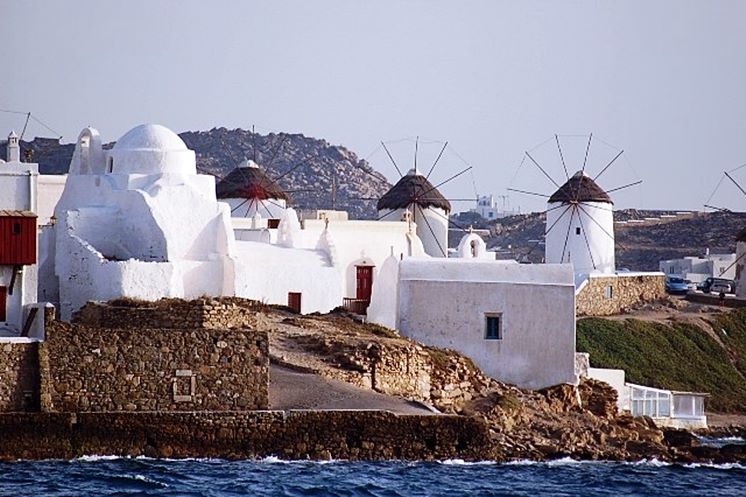
Chora, Mykonos, Cyclades,South Aegean
Castle of Mykonos
| Location: |
| West of the port of Chora of Mykonos |
| Region > Prefecture: |  |
| South Aegean Cyclades | |
| Municipality > Town: | |
| City of Mykonos • Chora | |
| Altitude: | |
| Elevation ≈ 5 m |
| Time of Construction | Origin | |
| 13th century | VENETIAN |
|
| Castle Type | Condition | |
| Island Citadel |
Few Remains
|
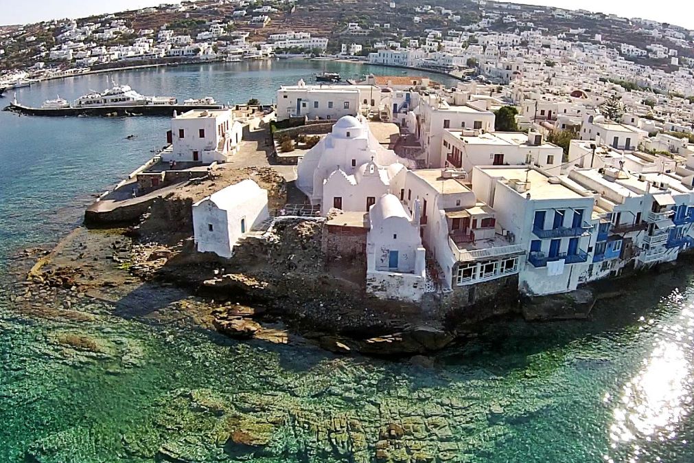
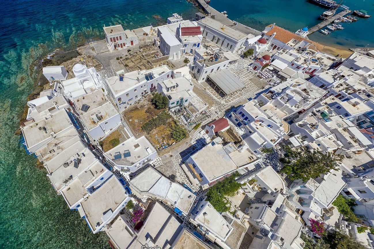
Remains of a castle at the port of Mykonos. It was once an important castle, but today there is almost nothing resembling a castle.
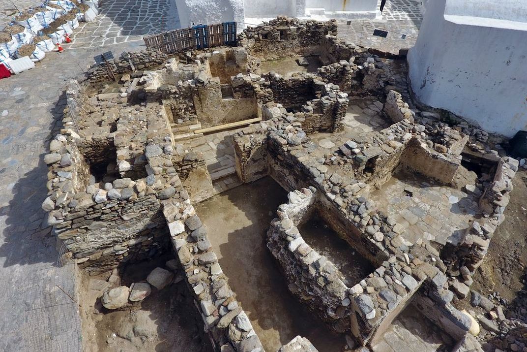
From the fortification, only the (hidden) ruins of two towers and a few parts of the sea wall are preserved.
History
The Castle is at a location, next to the port of the Chora, where continuous habitation has been documented from the early Bronze Age until the 19th century. Its current form is the result of continuous additions and interventions.
The castle existed at least since the Byzantine Period, as can be seen from the excavation findings, however it took its final form during the Venetian occupation, which for the Cyclades began after 1207, as a consequence of the sack of Constantinople by the Latins in 1204.
At that time, various Venetian adventurers who tried to seize the islands had landed in the southern Aegean. Tinos and Mykonos were conquered by the brothers Andrea and Geremia Ghizi, who belonged to the noble Ghizi Family of Venice and were nephews of Doge Enrico Dandolo. Andrea Ghisi became the first Venetian lord of the island under the sovereignty of the Duke of the Archipelago Marco Sanudo.
In 1390, when the last ruler of the Ghizi dynasty died childless, Mykonos passed directly under the jurisdiction of Venice, which held it until the middle of the 16th century. During this long period of Venetian rule, the castle of Chora of Mykonos was shaped and took its final shape.
The Italian monk and geographer Cristoforo Buondelmonti (1386 -~1430), who compiled detailed and reliable descriptions of the Venetian colonies in the Aegean during the 1420s, gives us an image of the castle of Mykonos (see ARTWORK above).
In 1537 Mykonos was one of the Aegean islands pillaged by Turkish pirate Hayredin Barbarossa and from then on the period of Turkish rule began for the island.
Inside the castle there was a large settlement already from the 2nd millennium BC. The settlement of the medieval castle was densely built, consisting mainly of two-storey houses with flat roofs that had access from the streets inside the castle, while during its late medieval phase its space would be occupied by the remains of ground-floor areas of buildings.
Among them stood t a mansion, lost today, which oral tradition names as the tower of the Ghizi, the Venetian lords.
During the 17th century, the existence of 11 church inside the castle is reported. The oldest of them was the double-vaulted church of Agia Eleni.
The extension of the settlement to the south, outside the castle, initially followed the layout and form of the houses within it, as can be seen from the dense arrangement of the two-story houses built in Parkia/ Barkia (Parikia), the first district of the Country outside the walls.
Towards the end of the 19th century, the space occupied by the castle was completely abandoned by the inhabitants. The houses were in ruins. Only the churches were preserved to some extent.
This situation changed drastically with tourism and the wider castle area began to develop again after the 1960s and ended up becoming one of the hottest tourist spots on the planet!
Structure, Fortification & Buildings
The area of the castle was about 8,800 sq.m. The perimeter of the enclosure was 365 meters.
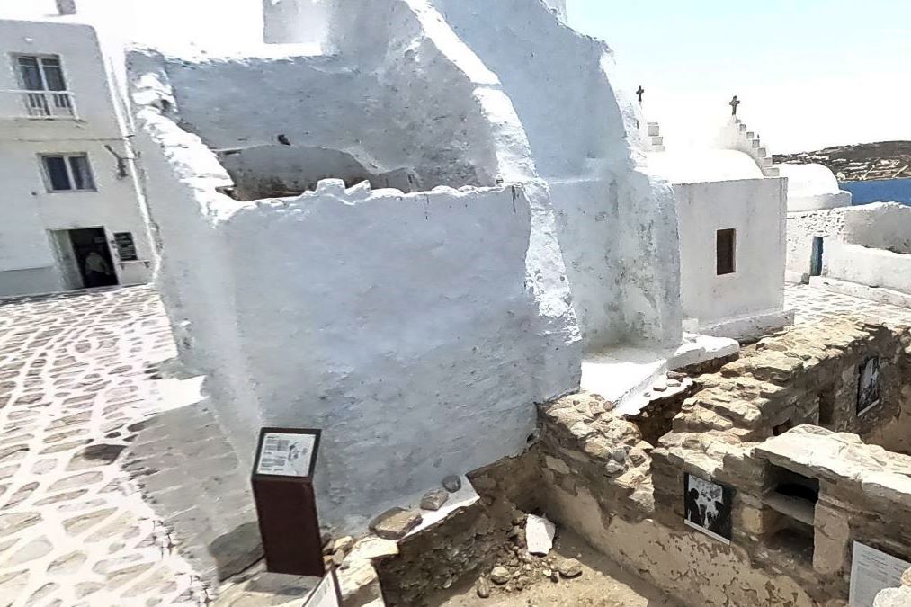
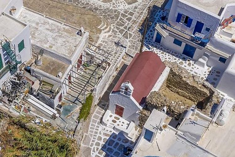
The castle was protected by a simple fortified enclosure reinforced with towers. Today the remains of two towers are preserved, the first (photos 4, 5, 6, 7) next to the complex of Panagia Paraportiani on the northwest side of the castle and the second (photo 8) next to the church of Panagia Pryani (Google Maps notes that it is the temple of Sotir) to the south.
There are three known entrance gates to the castle. Although not all of them have been preserved, some toponyms in the castle show their position, roughly defining its outline:
The Gialos Gate, already demolished at the beginning of the 20th century, was located to the SE of the current church of Agia Moni and connected the castle with the port. The Sabbia Nera (of the black sand), must also have led to the sea, and was probably on the south side of the castle. To the north-west, within the complex of Paraportiani, as the name implies, was the third gate, “Paraporti”.
The fortified enclosure must have followed the coastal front on the north and north-west sides of the castle, as can be seen from the excavation findings in the house that today is the Folk Museum, and in a neoclassical building in Little Venice.
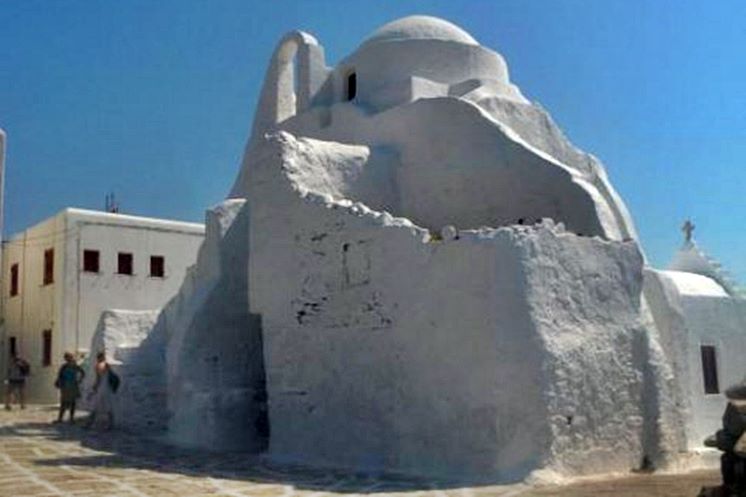
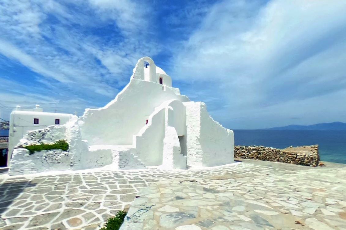
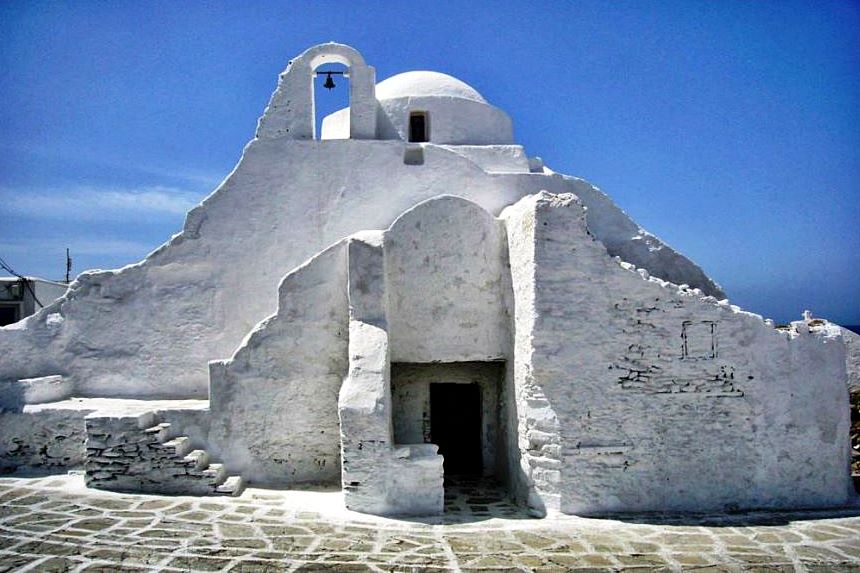
The most characteristic point of the castle of Mykonos is the two-storey complex of Panagia Paraportiani.
The upper floor of the complex is occupied by Panagia Paraportiani which belongs to the type of collapsed cruciform inscribed with dome church and which has been dated to the 16th - 17th century. On the ground floor of the complex, the once ruined buildings were converted in 1920 into 4 (!) single-aisled churches, Agios Efstathios just below Paraportiani, Agios Sozon, Agios Anargyros and Agia Anastasia on the west side. Inside the church of Agios Efstathios, a covered corridor 1.55m wide has been spotted (with ancient columns in its masonry) which was a passageway of the castle gate.
On the side, inside the church of Agios Anargyros, the strong 1.30m long pessos. bearing the supporting arches of its roof are a sure indication of the earliest use of the site as a tower. The presence of a tower in direct contact with the castle gate was an essential element of defense. The specific tower of Paraportiana has been dated to the Byzantine Period.
Similar findings have emerged from the excavation of the second tower next to Panagia Pryani on the southern edge of the castle. The tower is almost square in plan measuring 5.90✖5.80m, with strong walls 1.40–1.50m wide.
The hall on the ground floor was covered by a large opening semi-cylindrical vault with three transverse reinforcing arches. It was an impressive fortified building with at least two levels. Access to the interior of the tower was from the 2nd floor.
On the coastal fronts of the castle, parts of the fortification can be seen today in the reinforced outer walls of the groups of perimeter houses, in the northwest, in the so-called “Little Venice”, and in the north side, in the current Folk Museum. This course of the Venetian walls seems to continue an earlier building line, as in a seaside building in Little Venice, an earlier medieval construction with a cistern, as well as more ancient remains of a habitation, were discovered in its underground level.
There are wells in the area of the castle, however the settlement's water supply was mainly from the cisterns in the basements of the houses, which collected rainwater through pipes from their roofs.
| First entry in Kastrologos: | September 2024 |
Sources
- Website Cycladic Castles of the Ephorate of Antiquities of Cyclades, ΚΑΣΤΡΟ ΧΩΡΑΣ ΜΥΚΟΝΟΥ
|
|
| Access |
|---|
| Approach to the monument: |
| The remains of the castle are west of the port of Mykonos, at to the most touristic spot. |
| Entrance: |
| Free access. |
| Other castles around |
|---|
| Castle of Ghizi |
| Castle of Exombourgo |


