Ano Mera, Mykonos, Cyclades,South Aegean
Castle of Ghizi
| Location: |
| On a hill at the northern exit of the village Ano Mera of Mykonos island |
| Region > Prefecture: |  |
| South Aegean Cyclades | |
| Municipality > Town: | |
| City of Mykonos • Ano Mera | |
| Altitude: | |
|
Elevation ≈ 140 m (Relative Height≈50 m) |
| Time of Construction | Origin | |
| 13th century | VENETIAN |
|
| Castle Type | Condition | |
| Dry-Stone Fortification |
Rather Poor
|
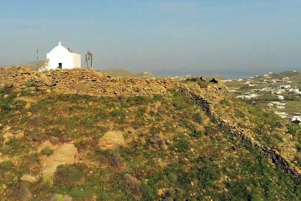
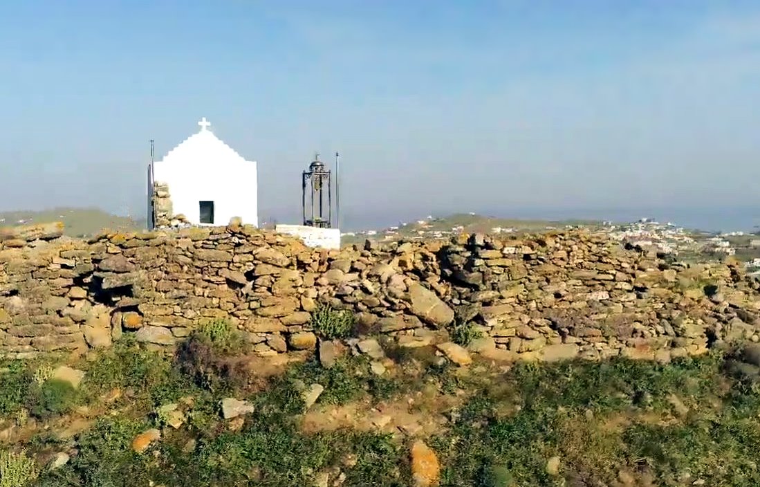
Remnants of a castle on a hill north of the village Ano Mera in Mykonos.
The main castle was atop the hill while there are medieval ruins around it including a small complex of buildings that is in relatively better condition, close to the road leading to the northern part of the island.
History
After the Fall of Constantinople in 1204, the islands of Tinos and Mykonos were given to the brothers Andrea and Ieremiah Ghizi from Venice. The Ghizi family ruled Mykonos until 1390.
The Venetian period ended in 1537 when Mykonos was pillaged by the Ottoman pirate/admiral Barbarossa.
The hill was fortified early in the Venetian period.
The castle was deserted in the Ottoman period. From the 14th until the 19th centuries the island was virtually occupied by pirates of various nationalities who using Mykonos as a base raided the rest of the Aegean.
Structure, Fortification & Buildings
The main castle is located at the top of the hill with an excellent view of the whole island, while around the hill there are various other remains of buildings from the medieval period. Among them is the complex of buildings that we see below, next to the road and which are referred to as “Ghizi Cmmand center” (photos 4,5,6,7). This small complex is the best-preserved part of fort, although it was outside its walls.
The fortification of Paleokastro is formed on the edge of the hill, occupying the entire plateau of its top, extending over an area of 2,840 square meters. The perimeter of the fortified enclosure is 205m. The fortification is simple without impressive defensive elements. It is strengthened by a projecting tower on the east side, next to the castle gate.
The walls are based on the natural rock and rise vertically. They are maintained throughout their perimeter, but at a relatively low height.
Their masonry is of 3 different types. In the lower part it consists of large elongated stones placed according to the isodomic system and it belongs the Hellenistic acropolis of the ancient city. The second part consists of smaller, relatively well-processed stones, without the interposition of vertical joints and using lime mortar as a binding material. In the upper part the masonry is more sloppy and consists of relatively small stones and extensive use of binding lime mortar.
The masonry indicate the chronological sequence of the building phases of Paleokastro, , beyond the ancient/demonstrates era, in its reconstruction during the Byzantine and Venetian periods of the island respectively.
Within the walls of Paleokastro, no buildings can be seen today, apart from the church of the Holy Trinity, due to the absence of archaeological research. The medieval settlement the population of which would have taken refuge within the walls must have extended to the E and SE slopes of the hill, which are also the smoothest.
| First entry in Kastrologos: | December 2015 | Last update of info and text: | October 2024 | Last addition of photo/video: | October 2024 |
Sources
- Website Cycladic Castles της Εφορείας Αρχαιοτήτων Κυκλάδων, ΠΑΛΑΙΟΚΑΣΤΡΟ ή ΚΑΣΤΡΟ ΓΚΙΖΗ ΜΥΚΟΝΟΥ
- Website Mykonensis - Το Φρουραρχείο των Γκύζη στο Παλαιόκαστρο Άνω Μεράς
- Video by the user Σταύρος Κουτσοθανας ΚΑΣΤΡΟ ΓΚΥΖΗ ΚΑΙ ΠΑΛΑΙΟΚΑΣΤΡΟ ΑΝΩ ΜΕΡΑΣ ΜΥΚΟΝΟΣ
- Information sent by Mr. Ioannis Dedes
- Information sent by Mr. Ioannis Dedes


