Arsakeio, Maroneia-Sapes, Rhodope,East Macedonia & Thrace
Fort of Arsakeio
| Location: |
| 1.7 km SW of the village Arsakeio in Rhodope prefecture |
| Region > Prefecture: |  |
| East Macedonia & Thrace Rhodope | |
| Municipality > Town: | |
| City of Maroneia-Sapes • Arsakeio | |
| Altitude: | |
| Elevation ≈ 70 m |
| Time of Construction | Origin | |
| perhaps 4th cent. | Early ΒΥΖΑΝΤΙΝΕ |
|
| Castle Type | Condition | |
| Castle Ruins |
Few Remains
|
Traces of a Roman and Early-Byzantine fortress SW from the village of Arsakeio (formerly Assakioi) in the prefecture of Rodopi.
It was a tetrapyrgion which was probably a station on the ancienr Via Egnatia.
History
There are no specific historical references to the castle. However, it is almost certain that its establishment and operation is related to the Via Engatia.
That means that it was a fortress-station on the Egnatia road between Maximianoupolis and Traianoupolis, dated in late antiquity until the early Byzantine period.
It must have been first built in the Late Roman Period (i.e. the 3rd or 4th century AD) and probably existed until the 6th century when it was perhaps repaired under Justinian. It must have fallen into disuse and been abandoned shortly after the 6th century when barbarian raids intensified (although it is possible that this happened earlier).
Other similar small forts/stations on Egnatia that survive today are at Petropigi and at Asprovalta, while Maximianoupolis/Mosynopolis was originally (before it developed into a large city) a station of Egnatia.
Based on the theory that the fortress was a station of the Via Egnatia, we can determine exactly which station of Egnatia it was.
In today's prefecture of Rodopi, the Via Egnatia first passed through Maxianoupolis (7km west of Komotini), then it followed a course towards Roditis, Arisvi, where the ruins of a bridge have been found, and somewhere at the height of Arsakeion it turned south. A little further down, after the village of Mesti (at the SW end of the Evros region) followed a semi-mountainous route to Makri and, further east, to Traianoupolis.
There are some historical sources that give information about the stations of Via Egnatia: According to the Itinerarium Antonini Augusti, the first stop after Maximianopolis was at a distance of 31.1 km and was called Brendice
In another source, in the Peutingeria Table (Tabula Peutingeria) it is mentioned as Brenzici which is probably identified with the fortress of Bre rebuilt by Justinian (527-565) as mentioned by Procopius. The distance of Maximianoupolis via Komotini, Roditis, Arisvi to the Arsakeion Fortress is 32 km, which is very close to 31.1 km that is mentioned in Itinerarium Antonini. It should be noted that Herodotus (5th century BC) several centuries before mentions the country of Vriantica where the Thracian group of the Kikones lived.
In another historical source, the Jerusalem Itinerary (Itinerarium Burdigalense or Bordeaux Itinerary) which is the oldest Christian itinerary (written by an anonymous pilgrim to the Holy Land from Bordeaux, in the year 333-334) is mentioned after Maximianopolis, the mutatio Breieropara at a distance of 14.8 km and at a distance of 29.6 km the mansio Berozicha. The latter fits both in distance and phonetically to the name Brendice and Brenzici.
Consequently the fortress of Arsakeion is probably identified with the late Roman Brendice or the early Byzantine Bre, but this is an assumption that needs further documentation.
However in the Synekdemus of Hierocles (census of the cities of Byzantium in the middle of the 6th century) the location is not mentioned. This means that either there was no settlement around the fortress or that at that time it had already been destroyed.
Structure, Fortification & Buildings
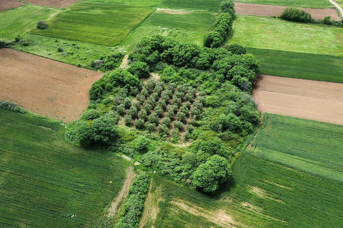
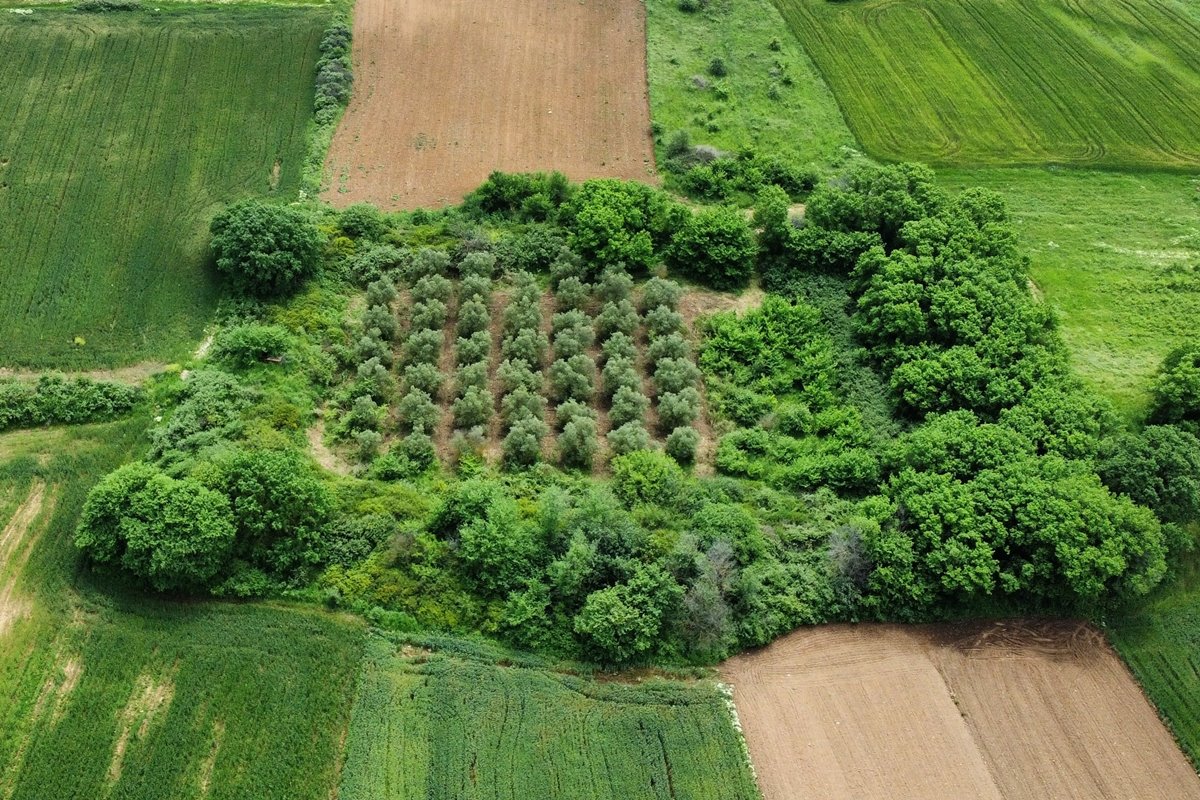
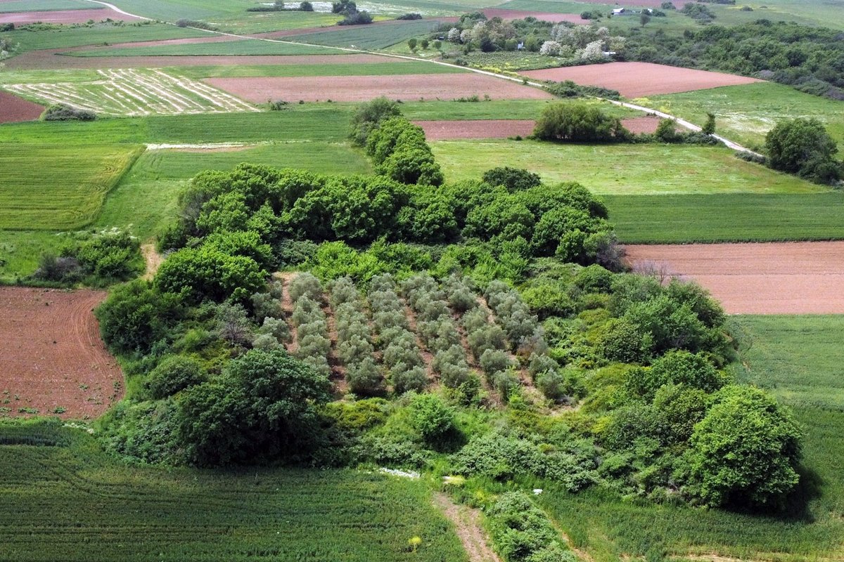
The fort is located on a flat plain. Around it, but also within it, there are cultivated fields.
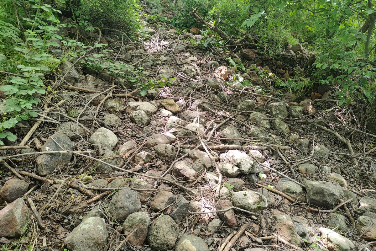
The fortification of the fortress is not visible because it is covered by dense vegetation. However, the outline of the fortification is rather distinct due to the elevated ground of the perimeter. In some places, stone piles can be seen in the vegetation. There are also fragments of ceramics throughout the area.
The castle had a quadrilateral shape and according to an earlier publication in the Archaeological Bulletin (1973-74) it had circular towers at its four corners. It was, in other words, a typical Roman “tetrapyrion”.
From the relief of the ground, it appears that the fortress had a rectangular shape with dimensions of 80✖55m. and with a perimeter of about 270 meters.
| First entry in Kastrologos: | June 2024 |
Sources
- Presentation, research and photos by Sakis Amfitreidis and his blog ΑΜΦΙΤΡΕΙΔΗΣ (April 2024)
- Δημήτριος Σ. Τσούρδης, Itinerarium Antonini Augusti και Itinerarium Burdigalense: Οι οικισμοί και πόλεις στην αιγιακή Θράκη κατά την αυτοκρατορική εποχή (27 π.Χ-330μ.Χ), σελ. 7-13.
- ΑΡΧΑΙΟΛΟΓΙΚΟΝ ΔΕΛΤΙΟΝ, τεύχος 29/Β3 (1973-1974), σελ. 835
|
|
| Access |
|---|
| Approach to the monument: |
| An easy dirt road starting from the south side of Arsakeion passes by the site of the fortress. |
| Entrance: |
| Free access. |
| Other castles around |
|---|
| Tower of Asproula |
| Tower at Mesimvria |
| Fortress of Gratini |
| Castle of Makri |
| Fortification of Maronia |
| Castle of Nea Santa in Rhodope |
| Acropolis of Petrota |


